
 +48 660 681 828
EN:
We provide professional land surveying and geodetic services for foreign clients buying, building, developing or managing property in Poland. We assist with measurements, documentation and surveying procedures required during construction and real estate projects.
ZH:
我们为在波兰购买、建设、开发或管理房地产的外国客户提供专业测绘服务。我们协助完成建筑和房地产项目所需的测量、技术文件及相关测绘工作。
VI:
Chúng tôi cung cấp các dịch vụ trắc địa chuyên nghiệp cho khách hàng nước ngoài mua, xây dựng, đầu tư hoặc quản lý bất động sản tại Ba Lan. Chúng tôi hỗ trợ đo đạc, chuẩn bị hồ sơ và thực hiện các công việc trắc địa cần thiết cho dự án xây dựng và bất động sản.
TR:
Polonya’da gayrimenkul satın alan, inşaat yapan, yatırım geliştiren veya mülk yöneten yabancı müşterilere profesyonel harita ve ölçüm hizmetleri sunuyoruz. İnşaat ve gayrimenkul projelerinde gerekli ölçüm, dokümantasyon ve aplikasyon işlemlerinde destek sağlıyoruz.
1. Map for Design Purposes
EN
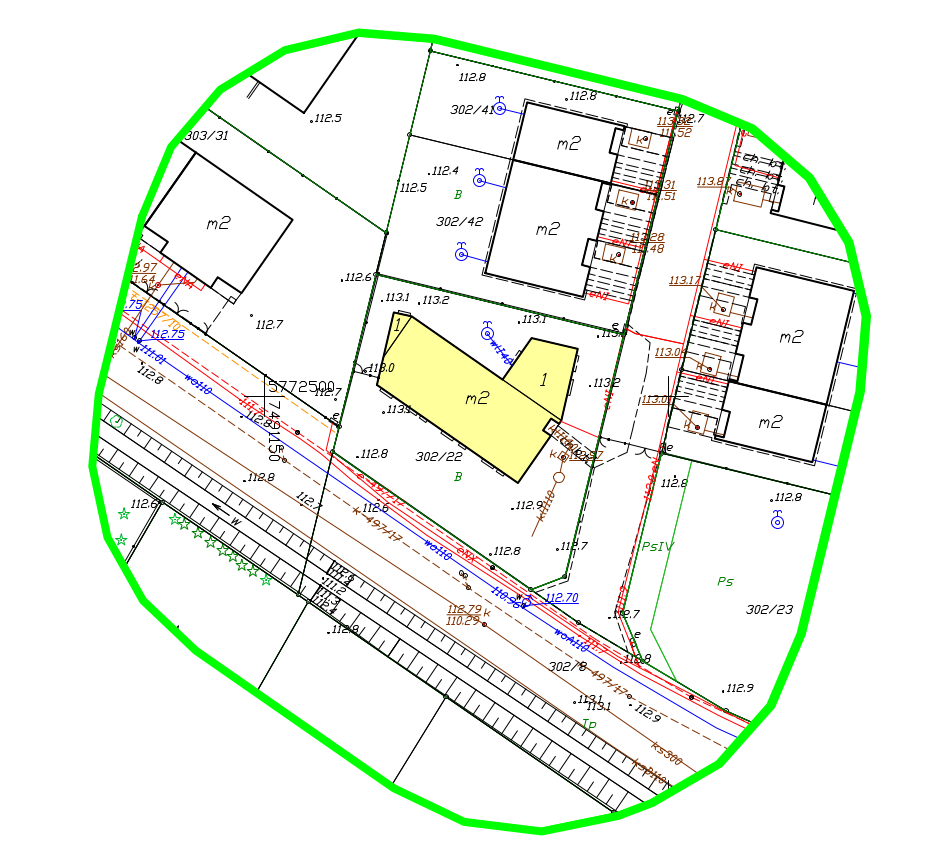
A map for design purposes is required when preparing many construction projects in Poland. It provides the designer or architect with up-to-date information about the plot, existing buildings, utilities and surrounding infrastructure.
ZH — 设计用测绘图
设计用测绘图是波兰许多建筑项目在设计阶段所需的基础文件。它为建筑师和设计人员提供有关地块、现有建筑、地下管线及周边基础设施的最新测绘信息。
VI — Bản đồ phục vụ thiết kế
Bản đồ phục vụ thiết kế là tài liệu cần thiết cho nhiều dự án xây dựng tại Ba Lan. Bản đồ cung cấp cho kiến trúc sư và đơn vị thiết kế thông tin cập nhật về khu đất, công trình hiện có, hệ thống kỹ thuật và cơ sở hạ tầng xung quanh.
TR — Proje Amaçlı Hâlihazır Harita
Proje amaçlı hâlihazır harita, Polonya’daki birçok inşaat projesinin hazırlanmasında gereklidir. Arsa, mevcut yapılar, altyapı hatları ve çevredeki tesisler hakkında güncel ölçüm bilgileri sağlar.
2. Building Setting Out
EN
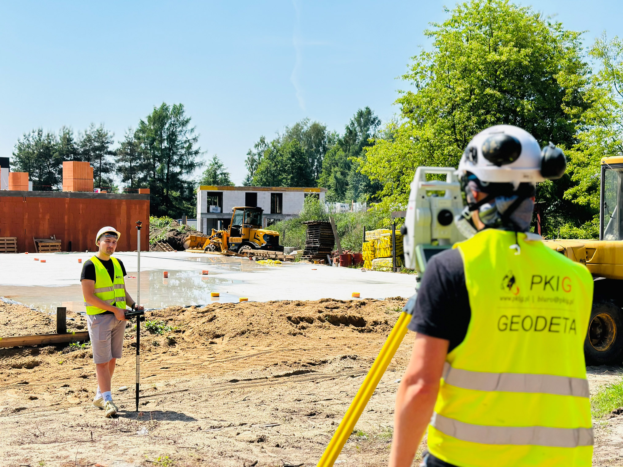
Building setting out transfers the position of the planned building from the design documentation onto the construction site. The surveyor precisely marks the location and key axes or points required before construction begins.
ZH — 建筑物放样测量
建筑物放样是将设计图纸中的建筑位置准确标定到施工现场。测量工程师会确定建筑物的位置、主要轴线及施工所需的关键点。
VI — Định vị công trình xây dựng
Định vị công trình là quá trình chuyển vị trí của công trình từ bản thiết kế ra thực địa. Kỹ sư trắc địa xác định chính xác vị trí, trục chính và các điểm cần thiết trước khi bắt đầu thi công.
TR — Bina Aplikasyonu
Bina aplikasyonu, projede belirtilen bina konumunun şantiye alanına hassas biçimde aktarılmasıdır. Harita mühendisi, inşaat başlamadan önce yapının konumunu, ana akslarını ve gerekli referans noktalarını belirler.
3. As-Built Survey of a Building
EN
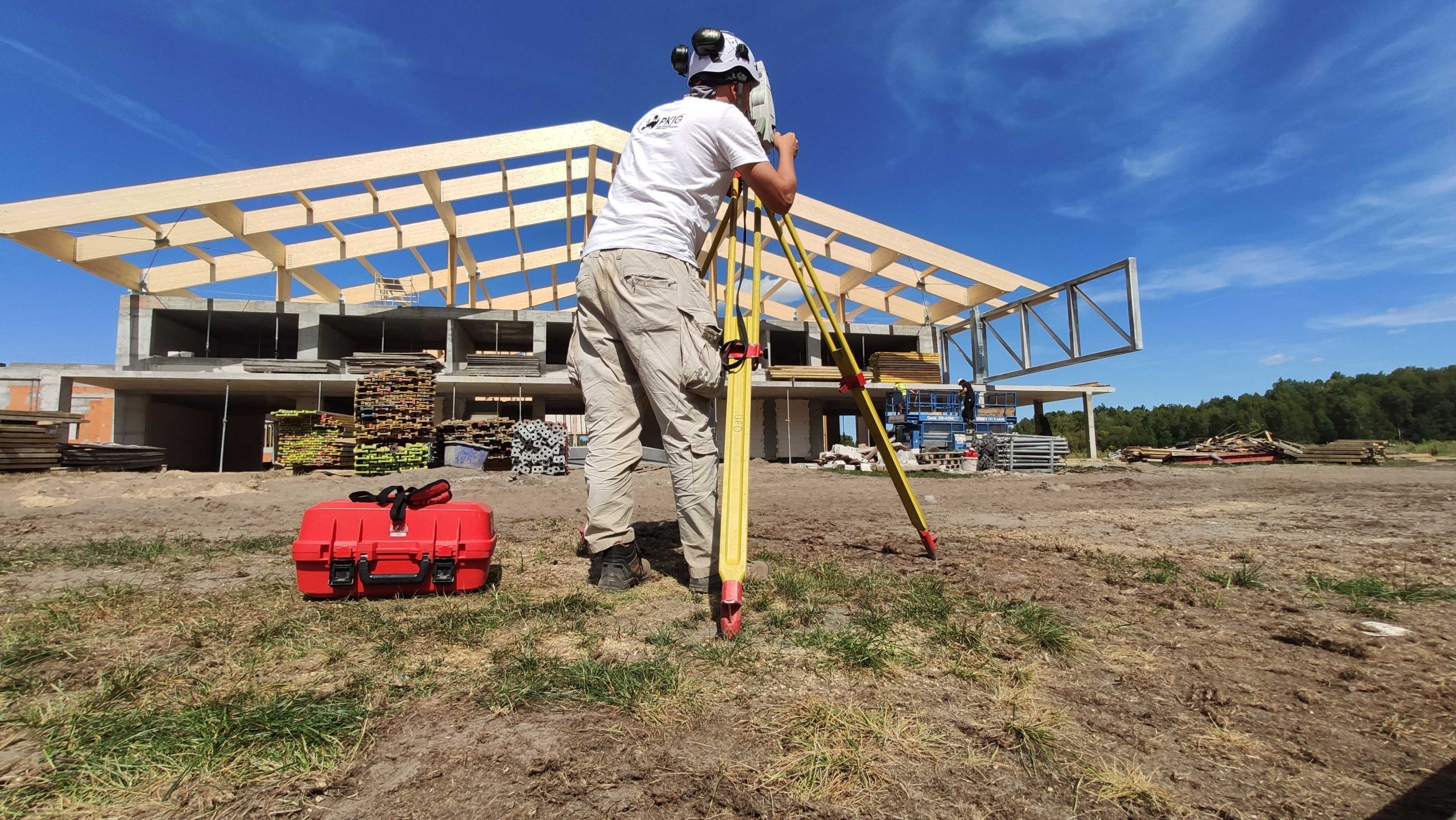
An as-built survey confirms the actual location and geometry of a completed building. The resulting surveying documentation can be used for completion procedures, technical records and updating official spatial data.
ZH — 建筑竣工测量
建筑竣工测量用于确认已建成建筑物的实际位置和几何尺寸。测量成果可用于竣工手续、技术资料整理以及相关官方数据的更新。
VI — Đo đạc hoàn công công trình
Đo đạc hoàn công xác nhận vị trí và kích thước thực tế của công trình sau khi xây dựng. Hồ sơ đo đạc có thể được sử dụng cho thủ tục hoàn công, hồ sơ kỹ thuật và cập nhật dữ liệu địa chính.
TR — Bina As-Built / Röleve Ölçümü
Tamamlanan bir yapının gerçek konumunu ve geometrisini belirlemek amacıyla yapılan ölçümdür. Hazırlanan ölçüm belgeleri yapı tamamlanma işlemlerinde, teknik kayıtlarda ve resmi verilerin güncellenmesinde kullanılabilir.
4. Property Subdivision
EN
Property subdivision allows one parcel of land to be divided into two or more separate plots. We assist with surveying documentation and the technical stages required to establish the new parcel boundaries.
ZH — 不动产分割测量
不动产分割可以将一块土地划分为两个或多个独立地块。我们协助完成测绘文件以及确定新地块边界所需的技术工作。
VI — Phân chia bất động sản
Phân chia bất động sản cho phép tách một thửa đất thành hai hoặc nhiều thửa riêng biệt. Chúng tôi hỗ trợ chuẩn bị hồ sơ trắc địa và thực hiện các công việc kỹ thuật cần thiết để xác định ranh giới mới.
TR — Taşınmazın Bölünmesi / İfrazı
Taşınmazın bölünmesi, tek bir parselin iki veya daha fazla bağımsız parsele ayrılmasını sağlar. Yeni parsel sınırlarının oluşturulması için gerekli ölçüm ve teknik dokümantasyon çalışmalarını yürütüyoruz.
5. Restoration of Property Boundaries
EN
Boundary restoration is used when existing boundary markers are missing, damaged or difficult to identify. Based on official surveying documentation, the surveyor restores the location of previously established boundary points in the field.
ZH — 界址点恢复与边界复测
当原有界址标志丢失、损坏或难以辨认时,可以进行界址点恢复。测量工程师依据官方测绘资料,在现场恢复先前确定的土地边界点。
VI — Khôi phục mốc ranh giới
Dịch vụ này được thực hiện khi mốc ranh giới bị mất, hư hỏng hoặc khó xác định. Dựa trên hồ sơ trắc địa chính thức, kỹ sư trắc địa xác định lại vị trí các điểm ranh giới đã được thiết lập trước đó.
TR — Sınır Noktalarının Yeniden Tesisi
Mevcut sınır işaretlerinin kaybolduğu, zarar gördüğü veya sahada belirlenmesinin zor olduğu durumlarda uygulanır. Harita mühendisi, resmi ölçüm belgelerine dayanarak daha önce belirlenmiş sınır noktalarını arazide yeniden tespit eder.
6. 3D Laser Scanning and BIM
EN
3D laser scanning provides fast and highly detailed spatial data about buildings, interiors and technical installations. The collected point cloud can be used to create accurate drawings, 3D models and BIM documentation.
ZH — 三维激光扫描与 BIM
三维激光扫描能够快速获取建筑物、室内空间和技术设施的高精度空间数据。采集的点云可用于制作精确的二维图纸、三维模型以及 BIM 文件。
VI — Quét Laser 3D và BIM
Quét laser 3D cho phép thu thập nhanh dữ liệu không gian có độ chính xác cao của công trình, nội thất và hệ thống kỹ thuật. Dữ liệu đám mây điểm có thể được sử dụng để lập bản vẽ, mô hình 3D và hồ sơ BIM.
TR — 3D Lazer Tarama ve BIM
3D lazer tarama; binalar, iç mekânlar ve teknik tesisatlar hakkında hızlı ve ayrıntılı mekânsal veri elde edilmesini sağlar. Elde edilen nokta bulutu, hassas çizimler, 3D modeller ve BIM dokümantasyonu oluşturmak için kullanılabilir.
EN:
Do you need surveying services in Poland? Contact us and tell us about your property or construction project. We will help you choose the appropriate surveying service.
ZH:
您在波兰需要测绘服务吗? 请联系我们并介绍您的房地产或建筑项目。我们将帮助您选择合适的测绘服务。
VI:
Bạn cần dịch vụ trắc địa tại Ba Lan? Hãy liên hệ với chúng tôi và cung cấp thông tin về bất động sản hoặc dự án xây dựng của bạn. Chúng tôi sẽ giúp bạn lựa chọn dịch vụ phù hợp.
TR:
Polonya’da harita ve ölçüm hizmetine mi ihtiyacınız var? Gayrimenkulünüz veya inşaat projeniz hakkında bizimle iletişime geçin. İhtiyacınıza uygun hizmeti belirlemenize yardımcı olalım.